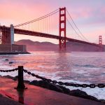
Monterey and San Francisco Bay Area are known for their stunning coastal landscapes, vibrant communities, and diverse attractions. However, ensuring public safety is a top priority for local authorities and residents alike. In recent years, various measures have been implemented to enhance safety and protect the well-being of those who live in or visit these regions.
In This Article
Key Points
- Authorities have increased security zones around high-value assets in San Francisco Bay, Delta Ports, Monterey Bay, and Humboldt Bay to protect against potential threats.
- Advanced digital elevation models and LiDAR data are being used to assess coastal inundation risks and inform emergency preparedness efforts.
- Collaborative efforts between federal, state, and local agencies are crucial in conducting search and rescue exercises and responding to emergencies.
Expanding Security Zones
In 2010, the Coast Guard proposed a permanent increase in security zone size from 100 yards to 500 yards around high-value assets such as cruise ships, tankers, and high-interest vessels in San Francisco Bay, Delta Ports, Monterey Bay, and Humboldt Bay. This measure aims to provide a more effective buffer against potential security threats and ensure the safety of these critical assets.
The expanded security zones apply to vessels that are underway, anchored, or moored within the navigable waters of these regions. By increasing the distance between high-value assets and potential threats, authorities can better monitor and respond to any suspicious activities or incidents.
Coastal Inundation Modeling and Emergency Preparedness
The National Oceanic and Atmospheric Administration (NOAA) Office for Coastal Management has developed a series of digital elevation models (DEMs) to assess coastal inundation risks in the San Francisco Bay and Monterey Bay areas. These DEMs incorporate the best available LiDAR data and are divided into smaller, more manageable sections based on county lines.
By utilizing these advanced modeling tools, local authorities and emergency responders can better understand the potential impacts of coastal flooding, storm surges, and sea-level rise. This information is crucial for developing effective emergency preparedness plans, identifying vulnerable areas, and allocating resources to mitigate risks and protect public safety.
Collaborative Search and Rescue Efforts
Ensuring public safety in the Monterey and San Francisco Bay Area requires close collaboration between federal, state, and local agencies. In September 2023, a multi-agency mass rescue operation was conducted off the City of Monterey, demonstrating the importance of coordinated efforts in responding to emergencies.
Regular search and rescue exercises allow agencies to practice their response protocols, share resources, and improve communication channels. By working together, these agencies can more effectively respond to incidents, save lives, and minimize the impact of emergencies on local communities.
Addressing Flood Threats and Extreme Weather
In recent years, the Monterey and San Francisco Bay Area have experienced significant flood threats and extreme weather events. In March 2024, a levee breach along the Pajaro River caused disastrous flooding, prompting authorities to fast-track the construction of a new flood control system.
To better predict and prepare for such events, the National Weather Service closely monitors climate forecasts and provides timely warnings to local communities. Residents are encouraged to stay informed about potential flood risks, follow evacuation orders when necessary, and take proactive steps to protect their properties and ensure their personal safety.
Enhancing Firework Display Safety
Firework displays are a popular form of entertainment in the Monterey and San Francisco Bay Area, but they also present potential safety risks. In 2010, the Coast Guard established a temporary safety zone in the navigable waters of Monterey Bay off the fishing pier of Seacliff State Beach to ensure the safety of participants and spectators during the Monte Foundation Firework Display.
By implementing safety zones and working closely with event organizers, authorities can minimize the risks associated with firework displays and ensure that these events are enjoyed safely by all.
FAQ
What can I do to stay safe during extreme weather events?
Stay informed about weather forecasts and warnings, follow evacuation orders when issued, and have an emergency plan in place for your family. Make sure to stock up on essential supplies, such as non-perishable food, water, and first-aid kits.
How can I report suspicious activities or potential security threats?
If you witness any suspicious activities or potential security threats, contact your local law enforcement agency immediately. Provide as much detail as possible, including the location, description of individuals involved, and the nature of the activity.
Are there any areas I should avoid during high surf or coastal flooding conditions?
During high surf or coastal flooding conditions, it is best to avoid beaches, coastal areas, and low-lying regions. Pay attention to beach closures and safety warnings issued by local authorities, and never attempt to enter the water when conditions are dangerous.
What should I do if I encounter a marine emergency?
If you encounter a marine emergency, such as a capsized boat or a person in distress, call 911 or the Coast Guard immediately. Provide your location, the nature of the emergency, and any other relevant information. Do not attempt to intervene directly unless you have the necessary skills and equipment to do so safely.

